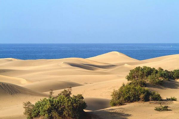
 The Canary Islands are rich in natural beauties, and millions of tourists from all over the world dream of seeing them. I have compiled for you the top 5 natural attractions of Gran Canaria, which everyone, who flies to this magical island should visit, and I described. how best to get to them.
Gran Canaria is not in vain called the “continent in miniature.” Here, during one daylight, you can swim in the ocean and lakes, take a walk in a miniature desert with real sand dunes, breathe in the pure coniferous aroma of pine forests, get above the clouds and see bizarre rocks, unusual flowers and dragon trees. If you flew to Gran Canaria for only 5-7 days, try to see at least 2-3 of the top attractions, described below. I am sure, you will remember the nature of this island for a long time.
The highest point of the island in Nublo Park
and the symbol of Gran Canaria – Roque Nublo
You can get a complete picture of Gran Canaria by viewing the island from a bird’s eye view. If you don’t have enough money for air walks, I advise you to visit Nublo Rural Park. The territory of this park, located in the center and in the south-west of Gran Canaria, covers an area of 263 km². Landscapes Nublo fascinate with its beauty. Here you can see volcanic formations, pine forests, gorges, mountain villages, unique flora and fauna.
Nublo Park has the status of a biosphere reserve, because 168 species of flowers, trees and shrubs grow on its territory, 53 of which are endemic to Gran Canaria and 64 live only on the Canary archipelago. Among them are gongaro flor de piedra (Gothic stone flower), taginaste de gui-gui, tomillon blanko (white thyme). In the park you can see local bird species. This is a blue finch, Canarian chiffon, Gran Canarian woodpecker, laurel and Canarian pigeons. There are many reptiles here. Since ancient times, the island is inhabited by the Gran Canarian giant lizard (Gallotia stehlini). You will definitely see geckos and lizards, when you will walk along the paths of the park.
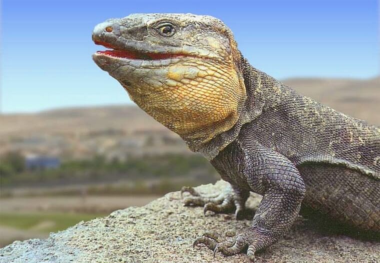
Giant gran-canarian lizard Gallotia_stehlini
If you are more interested in landscapes, be sure to visit Mount Nieves (Pico de las Nieves) – the snowy peak, that is the peak of the volcano. It is called the highest point of Gran Canaria (altitude 1949 m above sea level). According to official figures, this mountain is the second highest, as next to it is Morro de la Agujereada, whose peak is 1956 m, but it is less popular.
On the way up you will see, how the island’s flora is rapidly changing. Pine forests come to replace palm trees and cacti, the air gets colder and cleaner, then fog envelops you, and soon you find yourself above the clouds. This sight fascinates even experienced travelers.
Part of the territory of Pico de las Nieves is closed to the public, as here is a military radar base (station), whose rounded structure can be seen from afar. But a little lower you can visit the observation platform, which offers a fantastic view of the mountain serpentines, cliffs and gorges of the Rural Park, the beaches of the island and the Atlantic Ocean. It is worth coming here to meet the stunning beauty of the sunset. A pleasant bonus for you will be the Teide volcano, located in Tenerife. It, like part of the largest Canary Island, is perfectly visible in cloudless weather from the Snow Mountain.
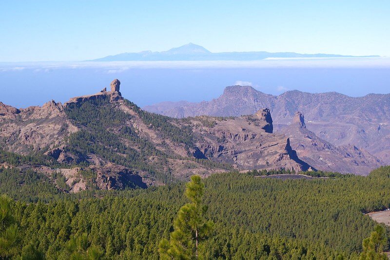
From viewpoint Pico de las Nieves you can see Tenerife island and Teide volcano
In the territory of Nublo Park is a popular attraction of the Canary Island and one of its main symbols – Roque Nublo. This is a rock located at an altitude of 1813 m above sea level, similar to a human finger, raised up 60 m to the sky. Hundreds of years ago, the Guanches, the indigenous inhabitants of Canary islands, considered Roque Nublo a sacred object. At its foot they sacrificed to the gods. It is a popular belief among tourists, that if you reach this “rock in the clouds” and touch it, making a wish, it will come true, because will be heard in heaven.
There are many beautiful places in the Nublo Biosphere Reserve, which you can see by walking along the developed hiking trails. Every corner of the park will give you unforgettable emotions.
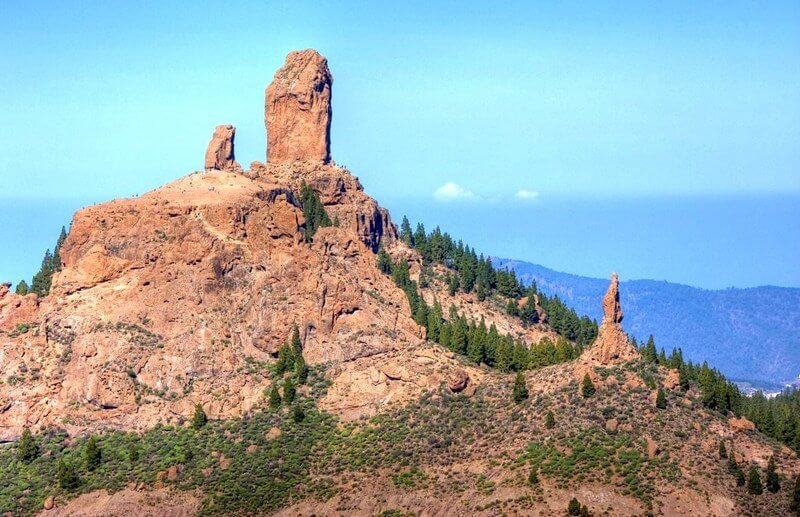
View at Roque Nublo (Gran Canaria island)
How to get there: It’s easier to get to the reserve from the capital of the island of Las Palmas de Gran Canaria. Buses number 303 and 305 will take you to the town of Tejeda. From there, the walking route to the attractions of Nublo Park begins. Walking takes from 2 hours, so be sure to bring water, some food and warm clothes, especially if you travel in the cold season, wear good sneakers or boots for trekking.
It is more convenient to get to the Nublo viewing platforms by car. The distance from the capital of the island to the park is about 50 km, and gasoline in Gran Canaria is inexpensive. Rent a car in the Canaries and explore the beauty of the island.
Canary Desert – Dunes de Maspalomas
If you have never been to the desert, but really want to get an idea of it, you do not have to fly or sail to Africa. Desert landscapes with dunes you can see on the Gran Canaria island. Yes, the island has a “small” desert with golden sand, which covers an area of 403 hectares. This is the Special Nature Reserve Dunes Maspalomas, located in the south of Gran Canaria near the city of the same name Maspalomas.
Contrary to the myth wandering in the vastness of the World Wide Web, sand on the Canary Island did not bring wind from Africa itself. Sand grains are particles of coral reefs, that formed long ago in the Atlantic Ocean. More than ten centuries ago, as a result of a glacier fracture, pieces broke off corals, that traveled along the waves for a long time, until an ocean current nailed them to the southern coast of Gran Canaria.
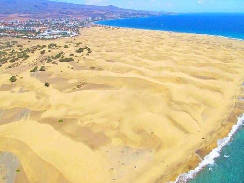
Maspalomas Dunes (Gran Canaria)
Here, particles of coral were blown by the winds, which eventually turned them into sand grains. Gradually there was so much sand, that whole hills formed – dunes. And the wind, blowing from the Atlantic, still continues its work – blowing sand from the ocean shore and driving it inland. This is how the dunes move. Every year, sand hills shift from east to west by 2-5 meters and are spreading already 3 km long.
Today, anyone can come to a nature reserve and enjoy a magnificent sight: the golden hills moving under the influence of the wind along the ocean line. You can see the dunes of Maspalomas from the observation deck located next to the information center at the Riu Palace Hotel. It is located in the northeast of the Maspalomas resort next to the Playa del Ingles (part of the beach can be seen using the Gran Canaria webcam Playa del Ingles). From here you can walk along a specially designed route to Maspalomas Beach. Along the way, you will see not only different types of dunes, but also representatives of the local fauna: lizards and beetles. Shrubs also grow here: tamarisk, gorse. Walking by camels are also organized for tourists on the dunes.

Dunes de Maspalomas (Gran Canaria) and Atlantic ocean
To the left of the dunes Maspalomas adjoins the natural lagoon of La Charca, separated from them by thickets of trees and bushes. Various waterfowl, as well as several species of herons, live in the lagoon. Migratory birds flying from Europe to Africa for the winter make a stop here. The water in the lagoon is mixed: sea and fresh. Endemic mollusks are found in it. By the way, nudists love to sunbathe near the lagoon.
Near La Charca is Maspalomas beach and begins a noisy tourist area with hotels, shops, casinos. But if you like seascapes, your feet will lead you to the old lighthouse (Faro de Maspalomas), located on the ocean. This lighthouse, built in 1890, is still operating and illuminates the way for ships. The lighthouse has a viewing platform, located at an altitude of 60 m. From here you can also admire the raging ocean, the resort and amazing natural formation – the desert on the island – Maspalomas dunes.
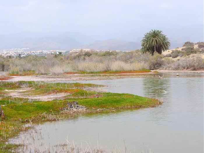
Laguna El Charca (Gran Canaria)
How to get there: If you arrived at Las Palmas Gran Canaria Airport, take bus number 66. It will take you to the end point of the route – Faro de Maspalomas (Maspalomas lighthouse). The fare is 4.05 euros. Travel time is 45 minutes. If you want to start exploring the dunes from the beach of Ingles, get off at the Playa del Ingles stop.
Guayadeque Gorge (Barranko de Guayadeque) –
in the footsteps of the Guanches
Another interesting attraction of the island of Gran Canaria, which combines the natural beauty and human activity, is the Guayadeque Gorge. This is an area of amazing beauty, stretching between high mountains for 15 km in length. A small stream with fresh water flows along the bottom of a winding gorge. And around grow almond trees, cacti, palm trees and flowers. The name of the Guayadeque Gorge is translated as “place of running water.” The stream supplies clean water to mountain villages, located in the surrounding area.
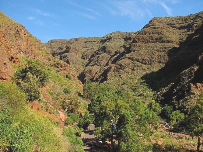
Barranco de Guayadeque, Gran Canaria
It is worth coming here not only to admire beautiful views of nature, but also to immerse yourself in the history of the Canary Islands. In the 16th century, the Spaniards conquered Gran Canaria, enslaved and destroyed the local inhabitants – the Guanches. The tribes of these tall fair-skinned people lived in natural caves or carved by them in the rocks. Scientists discovered their stone dwellings with drawings on the walls into the gorge in the 19th century. Also here were found funeral caves with mummies of the Guanches (this people knew, how to mummify the dead). On the territory of the Guayadeke Gorge there are several small chapels, as well as an information center and a museum carved into the rock. Here you can get acquainted with the life of an ancient people.
Until now, people live in these places, although their cave dwellings are equipped with electricity and running water. A few dozen cave houses have a unique microclimate: it is neither cold nor hot. If you wish, you can feel like an ancient resident of Gran Canaria and settle for 1-2 days in a cave hotel, which is located in Guayadeque. And if you only partially want to plunge into the life of the Guanches – go to the Tagoror restaurant, located in the largest cave, and try wine and local dishes in a unique place.
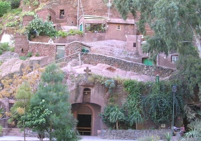
It looks like cave houses and a chapel in the Guayadeke gorge
At the end of the road, a 7 km long hiking trail begins, along which you can travel to the Los Marteles crater.
How to get there: From Las Palmas (San Telmo bus station) to the city of Aguimes 11 bus runs. Travel time is 40-45 minutes. Fare: 3.40 euros.
Walk around the caldera of an extinct volcano. Caldera de Bandama
Canary Islands are of volcanic origin. Once in Gran Canaria, you can sunbathe on black beaches with small particles of frozen lava and see, how grapes are grown on volcanic soil. An unforgettable adventure will be for you to climb to the top of one of the extinct volcanoes. May it be a Bandama. The last eruption of this geological formation occurred 2000 years ago, leaving behind a huge crater, or rather, the caldera (Caldera de Bandama). This dip goes to a depth of more than 200 m, and its diameter is 1000 m.
The volcano was named Bandama in honor of the Dutchman Daniel Van Damme, who settled on Gran Canaria in the 16th century and became a wine grower. He grew a vine at the bottom of an extinct volcano. If you have a desire, you can go down to the caldera along the laid paths and in half an hour you will see the ruins of a former distillery. The way up takes 45 minutes.
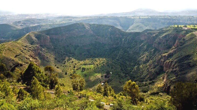
Caldera de Bandama (Gran Canaria)
Caldera de Bandama is partially overgrown with grass, flowers and trees and does not look as intimidating as a volcano has just erupted. You can estimate the size of the caldera by going to its edge. But the best view of the failure is from the nearby peak or Bandam peak. There, at an altitude of 569 m, there is an observation deck, from where you will see not only the caldera itself, but also the entire northeast of the island, together with its capital Las Palmas. In clear weather, you can see the island of Fuerteventura from here.
Getting there: The volcanic attraction is located near the capital of Gran Canaria. A bus 311 runs from Las Palmas (San Telmo bus station) to Bandama hourly. A ticket costs 1.55 euros. Travel time is 25 minutes. There are signs everywhere in Bandama, so you won’t get lost and quickly find the way to the observation deck.
Green mountains and pines of Tamadaba National Park
(Parque Natural Tamadaba)
In the west of the island on the hillsides is another natural landscape – Tamadaba National Park (Parque Natural Tamadaba). Its territory is 7.5 thousand m². Altitude ranges from 1000 to 1400 m. All lovers of trekking wants be here, as in addition to contemplating mountain canyons and forests, you can enjoy magnificent Atlantic landscapes – the park borders on the Atlantic.
Tamadaba is called a biosphere reserve, because it is here that you can see 25% of the endemic plants of Gran Canaria. Part of the park is a natural pine forest. It is called Pinar de Tamadaba. Canary pines with long (up to 30 cm) needles grow here. A moist pine forest cleans the air. Pinar de Tamadaba is worth a visit to people with a sore throat and lung. In some parts of Tamadaba, laurel, olive and dragon trees (dracaena), palm trees, rare species of cacti, juniper and Canary cedar grow.
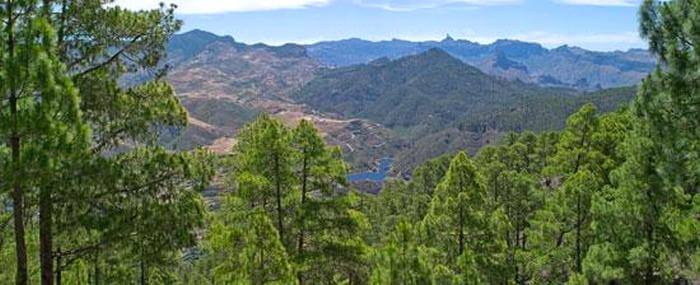
Landscape of Tamadaba National Park (Gran Canaria)
The fauna of the park is represented by such birds as peregrine falcon, shrike, blue reel, hawk, etc. Reptiles run along the ground: blue-tailed, green and giant lizards.
There are several hiking trails in the park. Green peaks look very nice against the sky. They resemble the Anaga Mountains in Tenerife. By the way, the largest Canary Island can also be seen walking along the high sections of Parque Natural Tamadaba.
Getting there: You can get to Tamadaba Park by public transport from Las Palmas de Gran Canaria (San Telmo Station) by bus number 103 (cost 3.10 euros, travel time about 40 minutes) with a transfer in the city of Galdar. Bus 101 runs from Galdar to El Risco. A ticket costs 2.75 euros. The journey takes about 45 minutes. Renting a car in Gran Canaria will save you time and make your trip to the park more comfortable. By car, drive towards the town of Agayete on the GC-216 highway. In an hour you will reach the park.
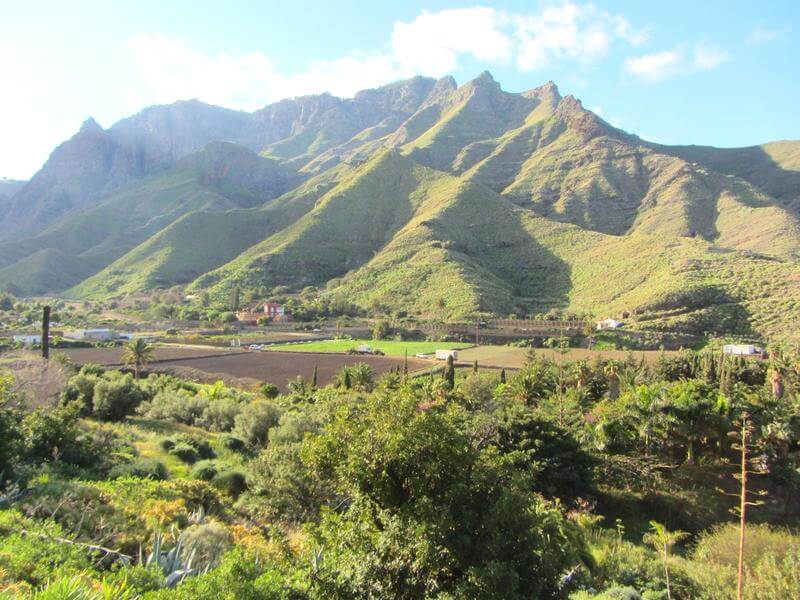
Green mountains of Gran Canaria
Of course, this article does not list all the attractions of Gran Canaria, but I tried to tell you about the most unusual and unique of them. Explore the nature of the Canary Islands and get an unforgettable vacation experience. In the comments, you can share what you saw on the “continent in Miniature” and advise other travelers about, what sights to visit in Gran Canaria.
